If Rubicon is a rite of passage, Fordyce is the final exam.
Tucked away in the high Sierra Nevada of Northern California, the Fordyce Jeep Trail isn’t just a trail—it’s a full-on adventure that tests your rig, your skills, and your grit.
Whether you’ve tamed Moab’s slickrock or clawed your way through Tennessee’s muddy hollows, nothing quite prepares you for Fordyce. This trail is rugged, raw, and relentless—and that’s why it draws hardcore wheelers year after year.
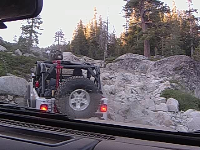
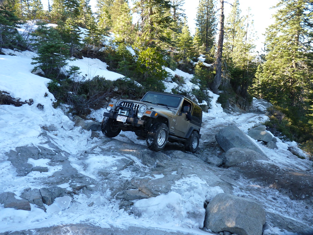
Table of contents
🏞️ Trail Overview
- Trail Name: Fordyce Jeep Trail
- Nearest Town: Soda Springs, California
- Trail Length: ~12 miles
- Difficulty Level: Extreme (Rated 9–10 out of 10)
- Management Agency: Tahoe National Forest, Yuba River Ranger District
- Best Time to Visit: Late June to early October (depending on snowmelt)
- Permits/Fees: No fee, but OHV registration is required
What You’ll Face
Think of Fordyce as Rubicon’s wild twin—shorter, but way more intense. You’ll be facing:
- Five gnarly winch hills (Winch Hill 1 to 5—each one progressively harder)
- Multiple river crossings, including the infamous Fordyce Creek, which can be impassable without careful timing
- Granite slabs, steep climbs, loose boulders, and ledges that will eat stock rigs for breakfast
Note: This isn’t a trail you just go do—you prepare for it.
Vehicle Requirements & Gear Checklist
If you’re running this trail, stock is not an option. Here’s what you need:
🔧 Vehicle Upgrades
- Lockers front and rear (100% required)
- At least 35” tires—but 37s or bigger are ideal
- Winch (do not attempt this trail without one)
- Heavy-duty suspension & armor—rock sliders, skids, bumpers
- Recovery gear (straps, shackles, tree savers, snatch block)
- CB or GMRS radio for communication
🏕️ Essential Gear
- Portable air compressor and tire repair kit
- Spare parts (axles, driveshafts, u-joints—bring what breaks)
- Camping gear (there are a few primitive spots near the river)
- Plenty of water and food—trail times vary widely, and you might be stuck overnight
- GPS or offline maps—cell service is non-existent
Getting There
Trailhead Location:
- Start Point: Meadow Lake (via Bowman Lake Road, near Nevada City/Soda Springs)
- End Point: Committee Crossing near Eagle Lakes Road
From I-80, take Bowman Lake Road to Meadow Lake—a rough 13-mile forest road best done in a high-clearance vehicle or tow rig.
Best Time to Go
Late summer is your window. Why?
- Early season (June-July) = high water = impassable crossings
- Late fall = snow can arrive suddenly
- Sweet spot: Mid-July through early September
Check water levels at Fordyce Creek before your trip. Ideal water depth: below 12 inches. Over 18? Better bring a snorkel and a prayer.
Other Activities Nearby
If you’ve got some energy left after Fordyce (or if your buddy broke an axle and you’re waiting for parts), here’s what else is around:
- Camping: Meadow Lake, Faucherie Lake, and Bowman Lake
- Fishing: High Sierra trout fishing is pristine up here
- Hiking & Biking Trails: The Grouse Ridge area offers killer views
- Swimming holes & alpine lakes: Ice cold and beautiful
Trail Stories
“We rolled in with three rigs—all built. By Winch Hill 3, we were down to one that hadn’t broken a driveshaft. Fordyce doesn’t play around.”
—Tony C., Sacramento
“The first time I crossed Fordyce Creek, I underestimated it. Water was up to the door handles. My seats were still wet a week later.”
—Jess H., Reno
Why Fordyce Is a Must-Do
- It will push your rig and your determination further than almost any other trail in California
- The scenery is untamed, remote, and utterly breathtaking
- You’ll earn bragging rights that mean something in the off-road community
- And most of all? You’ll walk away a better wheeler—guaranteed
Before You Go
- Check water levels at Fordyce Creek Real-Time Gauge
- Know the weather—storms can make the trail deadly
- Bring friends. This is NOT a solo trail. Ever.
Ready to Take on Fordyce?
Don’t just wheel—dominate.
Get your rig prepped, pack your gear, and answer the call of one of California’s most brutal off-road challenges. The trail is waiting… are you?